Report Bike Lane Obstructions
Snap a photo. Help map dangerous obstructions. Make Toronto's streets safer for everyone who rides.
We Need Your Help!
BikeEye is live on the App Store, and we're looking for early testers to help us improve the app and build a comprehensive dataset of bike lane obstructions.
Please download the app, log in, and start contributing! Your reports help us advocate for safer streets and better cycling infrastructure.
Quick & Easy
Report obstructions in just 2-3 taps with automatic location tagging
Real Impact
Your data helps advocate for better bike infrastructure in your city
Privacy First
PIPEDA compliant. Export or delete your data anytime
How It Works
BikeEye makes it effortless to document bike lane obstructions and contribute to safer streets.
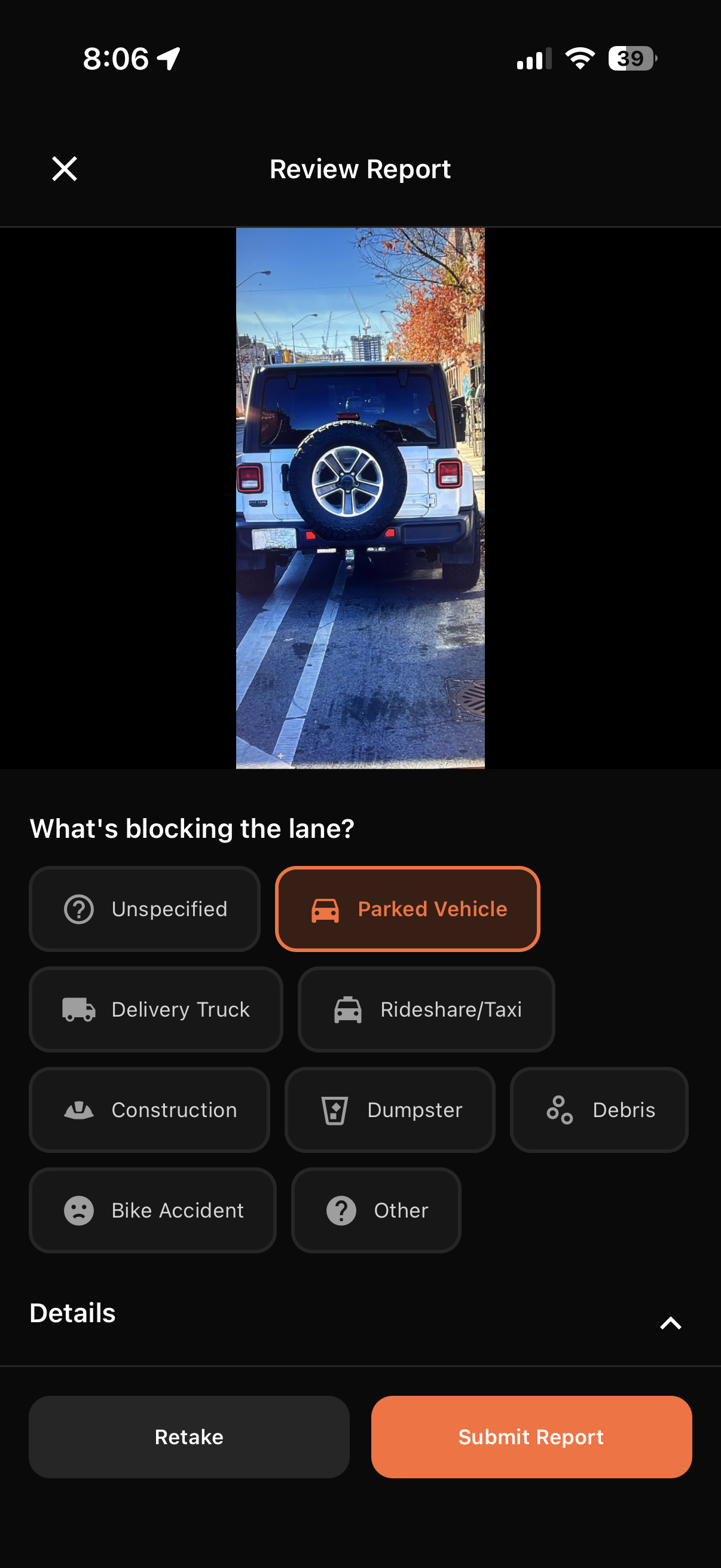
Spot an Obstruction
See a car, truck, or obstacle blocking a bike lane? Open BikeEye and snap a quick photo.
Auto-Submit Report
Location, time, and type are captured automatically. One tap to submit and keep riding.
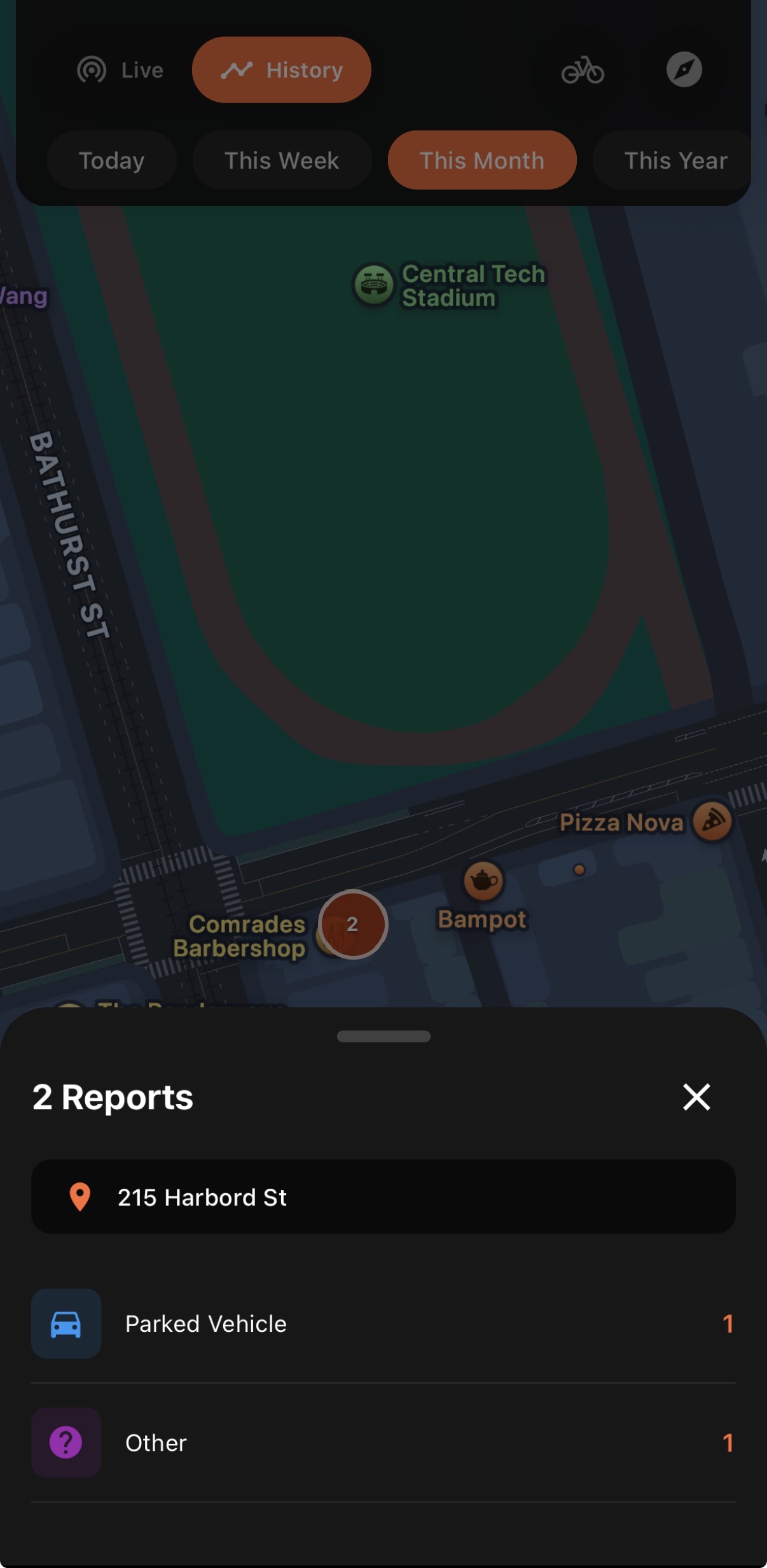
See the Heatmap
Reports aggregate into a live heatmap showing problem areas across Toronto.
Drive Change
City planners and advocates use this data to prioritize enforcement and infrastructure.
BikeEye Pro
Turn-by-turn navigation built for cyclists. Know exactly what kind of infrastructure you'll ride on before you leave.
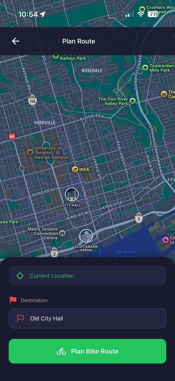
Plan your route
See infrastructure breakdown
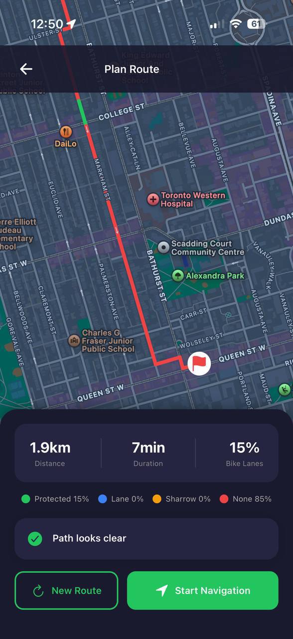
Check for obstructions
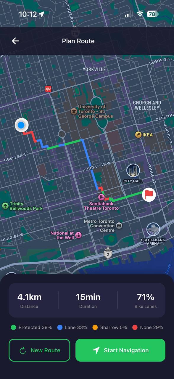
Color-Coded Routes
See protected lanes, painted lanes, sharrows, and unprotected roads at a glance
Infrastructure Stats
Know the percentage of protected vs. unprotected riding before you go
Obstruction Alerts
Get notified if there are reported obstructions along your planned route
Turn-by-Turn Nav
Real navigation built specifically for cyclists, not adapted from car routes
Ready to try BikeEye Pro?
Download on App StoreSee What's Happening Now
Explore the live map to see current bike lane obstructions reported by cyclists across Toronto.
Interactive map preview
Open Full MapOpen Data for Everyone
BikeEye data is available to city planners, researchers, and advocates. Download reports, analyze trends, and use the data to push for better cycling infrastructure.
- Download CSV or JSON exports
- Filter by date range, type, and location
- Historical data for trend analysis
Sample Data Preview
reports.json{
"reports": [
{
"id": "abc123",
"type": "parked_vehicle",
"lat": 43.6532,
"lng": -79.3832,
"created_at": "2026-01-29T10:30:00Z",
"ward": "Toronto Centre"
},
...
],
"total": 1247,
"generated_at": "2026-01-29T15:00:00Z"
}Download BikeEye Today
BikeEye is now available on the App Store. Download the app and start reporting bike lane obstructions in your city.